Blog Post

THE SECOND COMING

  • By tony kirby
  • 11 Dec, 2017

Ballycasheen Portal Tomb, Killinaboy.

“Sometimes one really does have to wonder why some monuments get signposted and some don't. Of the many spectacular tombs scattered around the Burren this has to be one of the worst!
It is terribly neglected and very overgrown. There is so little of the tomb to see, just a few slabs that were once the chamber”.
Description of Ballycasheen portal tomb by www.megalithomania.com in 2002
Ballycasheen tomb prior to scub removal. Pic courtesy of Mary Howard B.C.V.

INTRODUCTION

It is December 2017 and I train my binoculars through my kitchen window onto a field a couple of kilometres to the north. I can see for the first time Ballycasheen (Baile Chaisín Caisin’s place) portal tomb. The monument had been covered with blackthorn and bramble for decades. However, all changed on the 25th of November this year when a team of volunteers under the expert guidance of prehistoric archaeologist Ros O’Maolduin cut away the scrub in and around the monument.

The volunteer team is the Burren Conservation Volunteers (B.C.V). B.C.V. were set up in 2010 by the Burrenbeo Trust to answer a need for active conservation in the region. The Trust itself is a landscape charity. The Ballycasheen day was a hugely successful exercise in monument management.

B.CV. thus returned Ballycasheen in part to its former glory. I say “in part” as unfortunately the tomb is in a collapsed state with the two capstones no longer sitting spectacularly on the lateral standing stones. As a result Ballycasheen does not enjoy the “drama” of the sharply-tilted roof of the only other portal tomb in the Burren, Poulnabrone. The father of Burren archaeology, T.J. Westropp, lyrically referred to Poulnabrone as being noteworthy for ”the airy poise of its great top slab”.

Reference
“Archaeology of the Burren. Prehistoric Forts and Dolmens in North Clare”. T.J. Westropp. Clasp Press. 1999.


MEGALITHIC TOMBS

There are 3 types of megalithic tomb associated with the Early Neolithic period in Ireland (6,000 to 5,000 years ago). They are passage, court and portal tombs. Pioneer farmers reached the Burren and Ireland about 6,000 years ago. They brought with them a new mortuary tradition – interring their special dead in big stone structures. These megaliths are also very loud statements of territory. Perhaps most importantly of all, they served as temples. The living frequented the structures in order to commune with the otherworld.
The last in the suite of megalithic tombs is the wedge tomb, dating to the Late Neolithic period (5.000 to 4,000 years ago).

Conservation volunteers in action. Pic courtesy of Mary Howard B.C.V.

LANDSCAPE

Poulnabrone may have been a tribal boundary at the most northerly point of the Burren in Neolithic
times.
The tomb is located on a limestone pavement plateau in the uplands. Carleton Jones argues that the location may have denoted a frontier point with Ballyvaughan valley and its virgin oak woods below to the north.

Two of the eight Early Neolithic tombs so far discovered in the Burren are located between the river Fergus and Roughan Hill. They are the Ballycasheen portal tomb and a court tomb which lies 250 metres south-east of it. So in its turn,  the Ballycasheen portal may well have been built at a critical southern entry point to the region - situated as it is between the river and the hill.
This gap between hill and river seems to have also been a sought-after location of buildings of the élite in later, historical times – witness the Early Medieval (431 to 1169 A.D.) monastic site of Kilnaboy ; the ring fort of Caher Mór which may also date largely from the Early Medieval period and the Medieval (late 12th century - early 16th century A.D.) Leamaneh Castle entrance.

Refrences
“The Burren and the Aran Islands Exploring The Archaeology” Carleton Jones. The Collins Press. 2004.
“Temples of Stone. Exploring the Megalithic Tombs of Ireland” Carleton Jones. The Heritage Council. 2007.


FARMING

The economic and political power of the Neolithic communities was derived from farming - the most radical ecological experiment known to mankind. The pioneer farmers in the Burren opted to exploit the limestone pavement/thin soil areas (mostly in the uplands) rather than the thick glacial deposits over limestone (largely in the valleys). They chose the former as the tree complex of hazel and Scots pine was easier to cut with their polished stone axes. (The valleys had a dense cover of oak wood). The megalithic tombs are thus concentrated in the prehistoric upland farming landscape.

The pressure on the upland landscape of slash-and-burn and farming was heightened 3,000 years ago with a change to a wetter and windier climate. The result was a dramatic loss of soil and the exposure of more pavement in the hills.

The rocky hills were no longer viable for all year round farming due to dearth of soil. Economic activity and human settlement switched to the valleys.as the oak was removed. The overwhelming concentration of Early Medieval (400 A.D. to 1100 A.D.) monastic sites in the Burren valleys would suggest that by this period at the latest, most of human settlement had moved from uplands to lowlands.

The limestone pavement areas are still farmed to an extent in winter. It a transhumance tradition of uncertain origin whereby some farmers transfer their stock from the valleys on to what is locally known as the “crag land”.
The tradition has been in decline over the last 50 years or so with the inevitable ecological succession of scrub. Scrub is an enemy of archaeology and that is why the BCV opted to remove it in Ballycasheen.


Poulnabrone portal tomb with one of two capstones still in place.

WHAT MAY LIE BENEATH

There are just less than 100 megalithic tombs recorded in the Burren and Poulnabrone is one of the few have been excavated. We can surmise to an extent from the Poulnabrone findings what may lie below the earth at the Ballycasheen portal.

It was Ann Lynch and a team of National Monument archaeologists who excavated in 1996-98. They found the remains of 33 individuals. Some of the remains were charred and some unburned. The team also found bones of wild and domestic animals as well as grave goods including stone and bone artefacts and a small polished stone axe.

Ann Lynch concluded from examination of the human bones that the interred had had short, physical and violent lives. The date range of the bones is about 600 years – 3800 B.C. to 3200 B.C. approximately – extremely selective burial of the dead.

Reference
Poulnabrone: An Early Neolithic Portal Tomb in Ireland”. Ann Lynch. Department of Arts, Heritage and the Gaeltacht. 2014.

The sign post at Ballycasheen

MYTHOLOGY and FOLKLORE

The Ballycasheen sign post on the road refers to the tomb in Gaelic as “Leaba”. There are still a small number of elderly people in the parish of Killinaboy who refer to certain megalithic tombs as “leabas”.

Diarmaid and Gráinne are two parts of a love triangle in a tale from the Fenian Cycle of Mythology. Many Stone Age tombs with flat roofs around Ireland were believed to be used as overnight refuges by the couple in order to hide from the pursuing warrior Fionn Mac Cumhaill. These monuments were known as Leaba Dhiarmada agus Ghráinne – Diarmaid and Gráinne’s bed.

W.G. Wood Martin points out that the monuments were also linked with “aphrodisiac customs”. Martin recounts Hely Dutton’s experience related to his search for the Ballycashen monument in 1808. Dutton was visiting the monument as part of his work for the publication “A Statistical Survey of County Clare” commissioned by the R.D.S.

When Dutton asked a couple of local women directions, they indulged in an animated chat together in Gaelic. The younger one eventually undertook to accompany Dutton to the tomb on the understanding that he was a stranger to the area (not local) and that he would give her his name.

Dutton became impatient and rode off. He subsequently told another local woman of his encounter and her comment was 'No wonder for them, for it was the custom that if she went with a stranger to Diarmaid and Gráinne's bed, she was certainly to grant him everything he asked.'

The “leabas” were also centres of fertility ritual. Wood Martin comments that “No doubt but that from Pagan times comes the widespread notion that these "beds" were efficacious in cases of barrenness. Hely Dutton remarked that if a woman were infertile, a visit with her husband to Diarmaid and Gráinne’s bed would cure her.

References
“A Statistical Survey of County Clare” Hely Dutton, 1808.
“Traces of the Elder Faiths of Ireland ; A Folklore Sketch ; A Handbook of Irish Pre-Christian Traditions” W. G. Wood-Martin, 1902.

Poulnabrone with displaced capstone lying on the ground

TOURISM

The original structures of Poulnabrone and Ballycasheen each had two capstones. The only capstone surviving on lateral stones now is the one at Poulnabrone.

This massive sloping capstone explains in part why Poulnabrone attracts up to 200,000 visitors per annum, (electronic counter on site). The antiquity of the monument and the accessibility of the site are the other main reasons why Poulnabrone is the most visited tourist site in the Burren. (The site is roadside on the R480, a major arterial route through the region).

From my own observations, I would find it hard to imagine Ballycasheen having any more than a couple of hundred visitors per annum. The monument’s tiny visitor numbers are explained in part by its location on a minor road ; its occlusion by scrub for decades ; its collapsed state and the displacement of its tilted roof.


EXCAVATION

Excavation of archaeological monuments in the Republic of Ireland can only be acted on with an excavation license. Under the National Monuments Acts, ownership of any archaeological object with no known owner is vested in the State. This means in effect that all archaeological findings must be transferred permanently to the National Museum of Ireland after examination. Thus, Poulnabrone is a funerary monument devoid of its dead - an empty tomb.

Only a minority of archaeological finds are actually exhibited in the National Museum’s public site in Kildare St in Dublin. The majority of objects are held in a facility in Swords, North County Dublin. The National Museum of Ireland – Central Resource Collection is in an industrial unit which was formerly the home of a Motorola electronics assembly plant.The 18,000 square metre building is the size of two football fields and houses several million archaeological objects.

There are no plans currently to excavate the Ballycasheen tomb. As only a small fraction of the region’s archaeological monuments has ever been excavated, the fate of our ancestors at Ballycasheen may be to rest in peace in their house of death.

Ballycasheen tomb after scrub removal.

CONCLUSION

Ballycasheen is one of only two portal tombs in the Burren. Moreover, it is one of the few Early Neolithic tombs which has been discovered in the region. It is a monument of real cultural significance in the Burren’s prehistoric landscape.

Ballycaseheen has had the good fortune to be “unveiled” again by conservationists. The second coming of the tomb means that a visit to the site is now a gem of a Burren experience. Its luck could hold out as it will never be overwhelmed by visitors and may also elude the excavators.

The turning of the year was an occasion of real spiritual significance to prehistoric farming communities. It marked the start of the journey from darkness in to light. The Ballycasheen site is a very soulful place to be on a sunny mid-winter’s day. Enjoy the holidays and the turning of the year.

By tony kirby 22 Mar, 2024

INTRODUCTION
Irish (or Gaelic) is one of the oldest living languages in Europe. It is a Celtic language and part of the Indo-European family.Irish declined dramatically as the majority language in Clare and Ireland in the 19th century.The last native Irish speaker in County Clare, the seanchaí (storyteller) Paddy Pháraic Mhichíl, died in Doolin the early 1990s.

Though dead as a native language in Clare, Irish is still spoken in the Burren today as a second language by a small minority of tenacious Irish language enthusiasts.

The Great Hunger of the 1840s saw the disappearance through death and emigration of up to three million people – mostly native Irish speakers. In the post-Famine period, a burgeoning Irish middle-class adopted the English language as a means of advancing themselves within the British administration in Ireland. Moreover, the same administration conducted a radical and often brutal programme of linguistic colonisation, most notably through the National Schools.

The 19th century linguistic imposition also involved family and place names being anglicised.

By tony kirby 07 Feb, 2022
INTRODUCTION
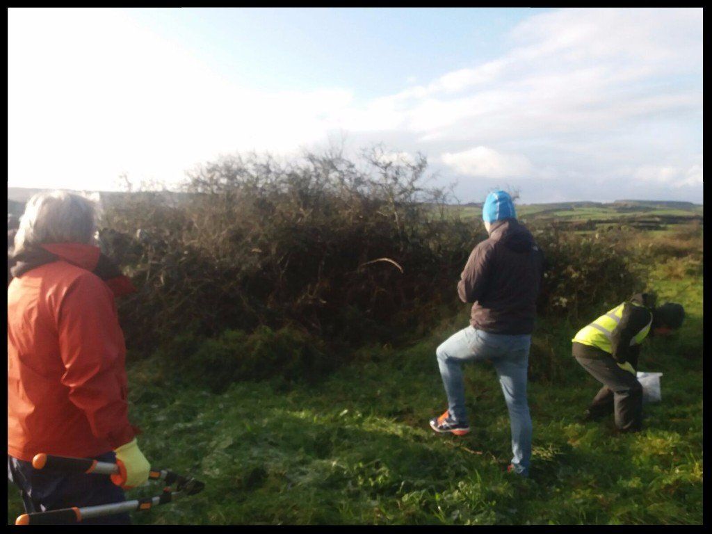
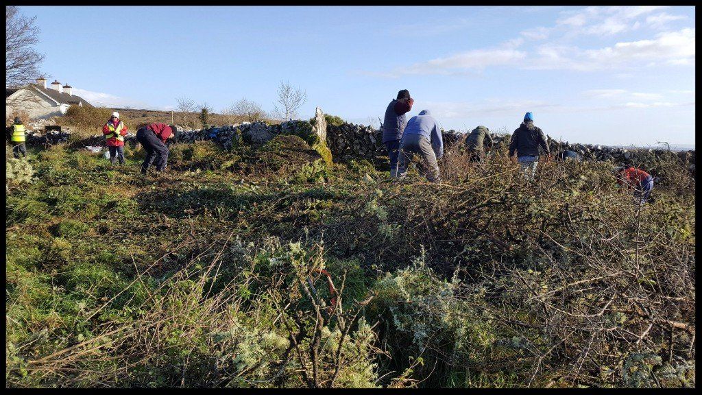
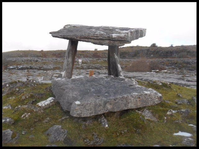
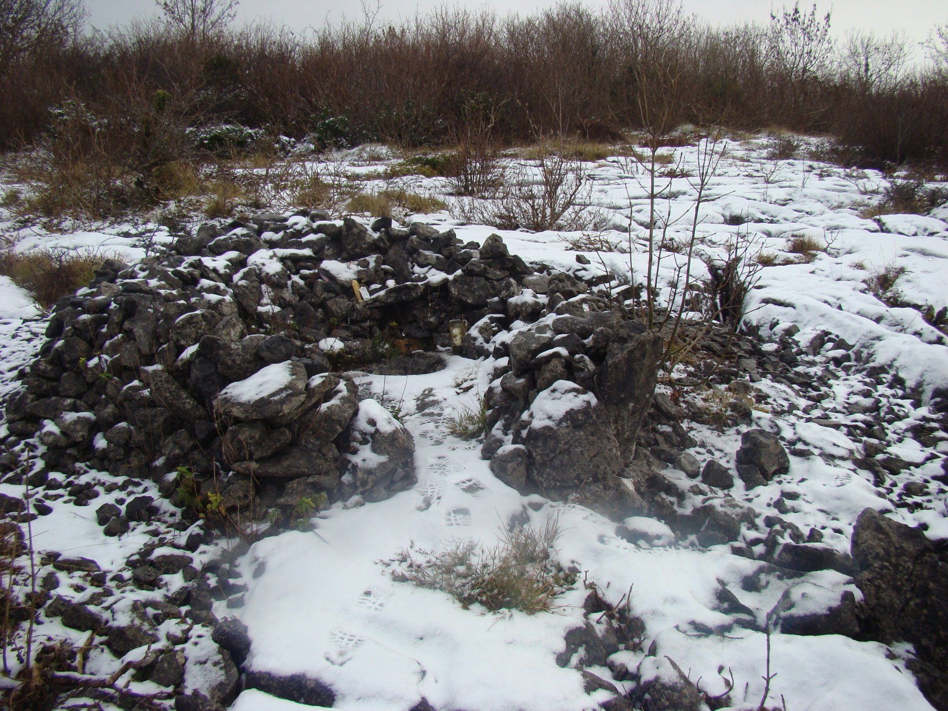
The placename Glencolmcille comes from the Irish Gleann Cholm Cille  meaning the valley of St Colmcille. Glencolmcille is today a sparsely-populated, fertile valley 5.5 kilometres east of Carran, the only village in the Burren hills. An ancient pass ran through the valley in the past providing a critical link between the Burren region and the outside world to the east of it. The importance of this routeway is reflected in the location of many signature sites along it, including four castles in Glencolmcille itself along with an ecclesiastical site of Early Medieval (431-1169) origin. According to tradition, the latter was founded by the renowned monk, Colmcille. The ruin of a church and a graveyard (still in use) stand today on the former ecclesiastical site. The church is considered to date from the 12th century.
By info@heartofburrenwalks.com 24 Feb, 2021

Saintesses like Ita, Brigid and Gobnait are in and around Imbolg but Iníon Baoith is an outlier on the calendar. Her patron day is December 29th - round about the winter solstice.

Her cult is strongest in Killinaboy in Clare where amongst other monuments, there are four holy wells dedicated to her.

Toberineenboy (Tobar Inion Baoith) is on commonage in Commons South and is renowned for cure for sore eyes or warts.
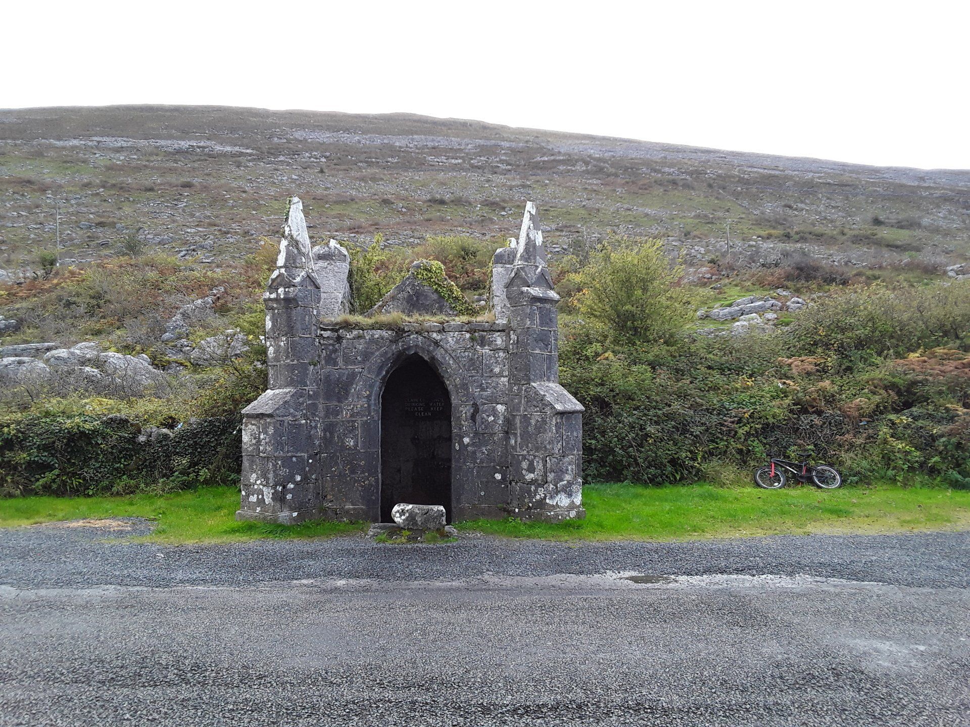
By info@heartofburrenwalks.com 28 Jan, 2021

‘Tobar Chornáin, near Black Head.
Perhaps the most decorative of the many wells, holy or otherwise, which dot the Burren’.
Peadar O’Dowd.

Tobercornan was a natural spring before it was ‘welled’.
One presumes it was welled when it was canopied.

That happened circa 1860 and so thereafter Gleninagh North had two canopied wells.
The other well is Tobernacrohaneeve, Tobar Na Chroíche Naoimh, only one km away.
Is Gleninagh North the only townland in all of County Clare with, not one, but two canopied wells?

Officially known as Tobercornan, Tobar Chornáin. Now commonly known as the Pinnacle Well.
Discounted by some as not being holy historically though Cooke did state in the 1840s  that ‘The neighbouring peasantry call it a Blessed Well.’

The Tobercornan well house was probably commissioned by the land lord, Bagot Blood. Extravagant and all as the design is, it can hardly be defined as a folly as it did serve a function, i.e., shelter for the water users.
By info@heartofburrenwalks.com 22 Jan, 2021
Il Blu Depinto di Blu,  in the blue painted in blue, in the Burren National Park at the turning of the year 2020. Air temperature was no more than 4 degrees Celsius. A north wind is blowing Arctic air down on us - a phenomenon known locally as 'The Black Wind'.

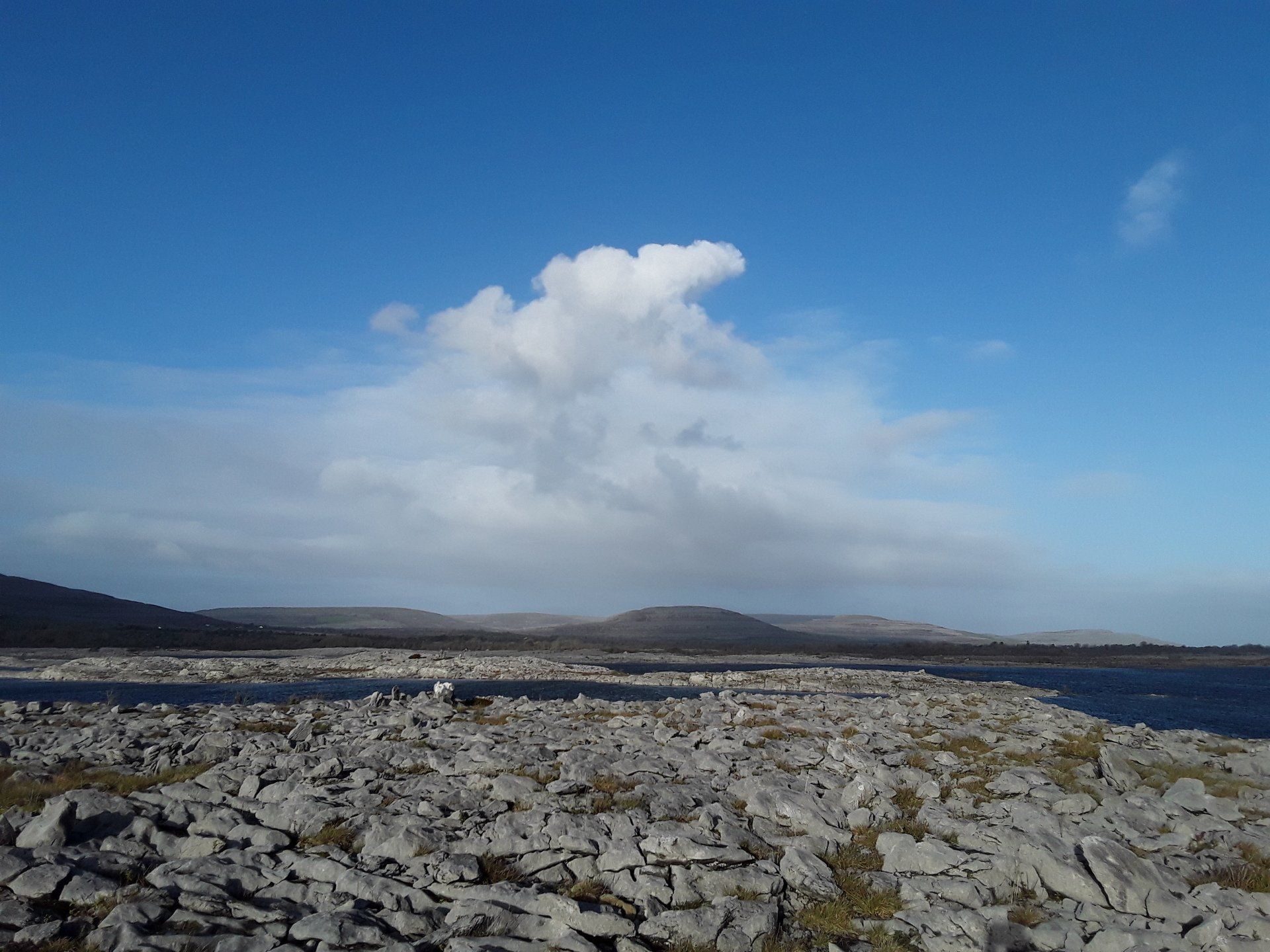
The location is Creehaun (Killinaboy), one of 64,000 plus townlands in Ireland. Creehaun measures almost 270 hectares and it does not have a single inhabitant. The place name is a mangling of Crítheán , a bushy place

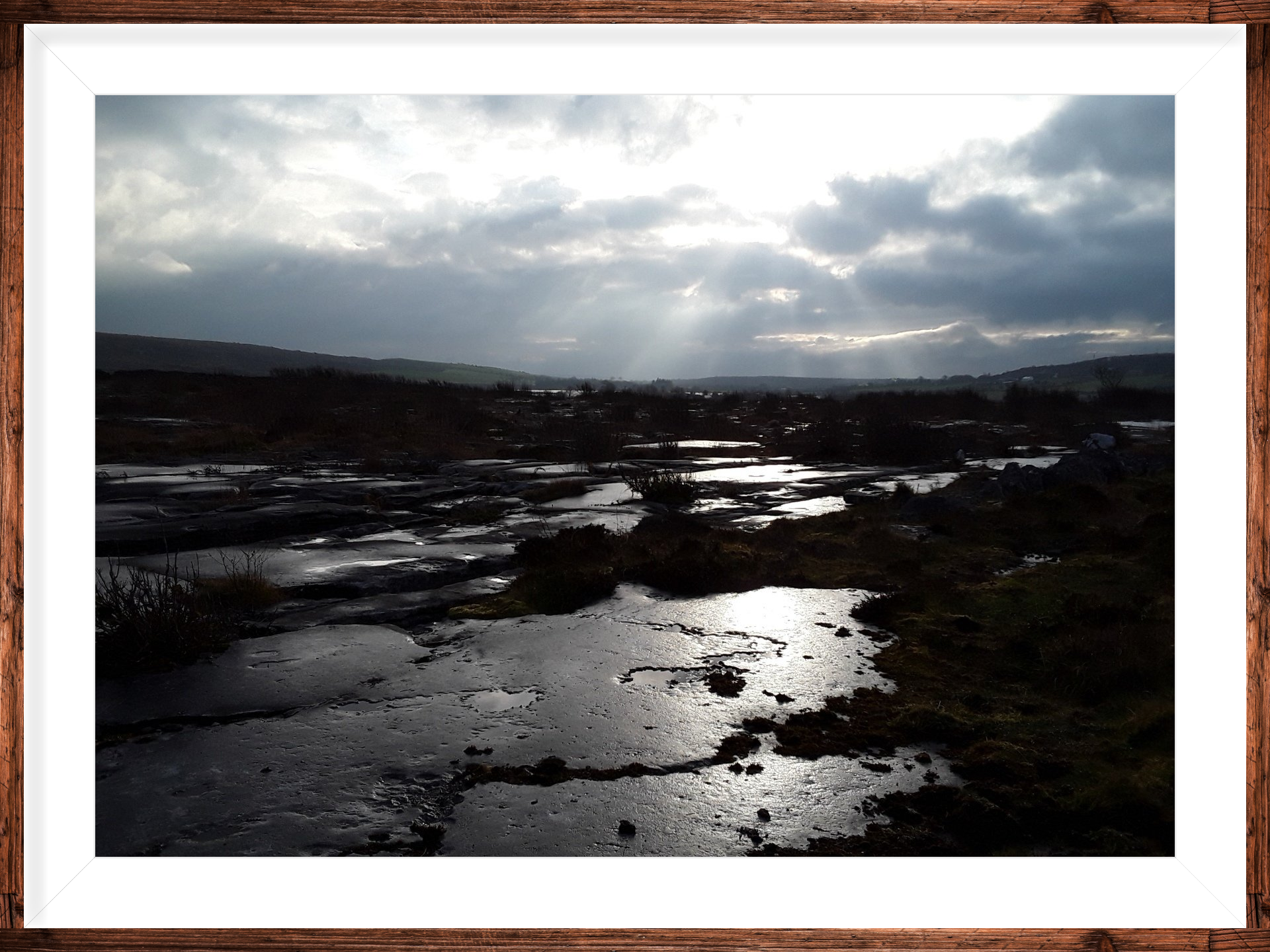
The big water body is a dramatic winter merger of three lakes - Loch Sceach Ard (high bush lake), Loch Trá Bhán (white strand lake) and Loch Cúil Úrta (damp wood lake).

The three most easterly peaks beyond the water make up the Turloughmore range - a seldom-trod part of the National Park. The heights are 200m, 224m and 267m.

Stone, water, uplands... but the star of the show is the 'candy floss' - cumulus fractus.

Fractus clouds have this jagged, shredded appearance as they are seared by strong winds. They are indicators of fair weather and do not contain precipitation. (Thanks to Nick Geh for the identification). 

Il Blu Depinto di Blu is the title of a song more commonly known as 'Volare' written by Domenico Modugno and released in 1958. Domenico died in 1994 but his song has not ended.  A presto!
By info@heartofburrenwalks.com 24 Dec, 2020

The less well known of the two St Flannan's Wells in Inagh, County Clare. Flannan being the patron saint of the parish of Inagh. Flannan's day is over - just. It falls on December 18th. "If a person went on the eighteenth of December he would not have to go anymore." (Schools Collection Vol 0611 p. 109).

The well is in a remote location now in Muckinish. It was not always thus. Once the well was located along the old bog road between Ennistymon and Inagh.

By info@heartofburrenwalks.com 06 Jul, 2020

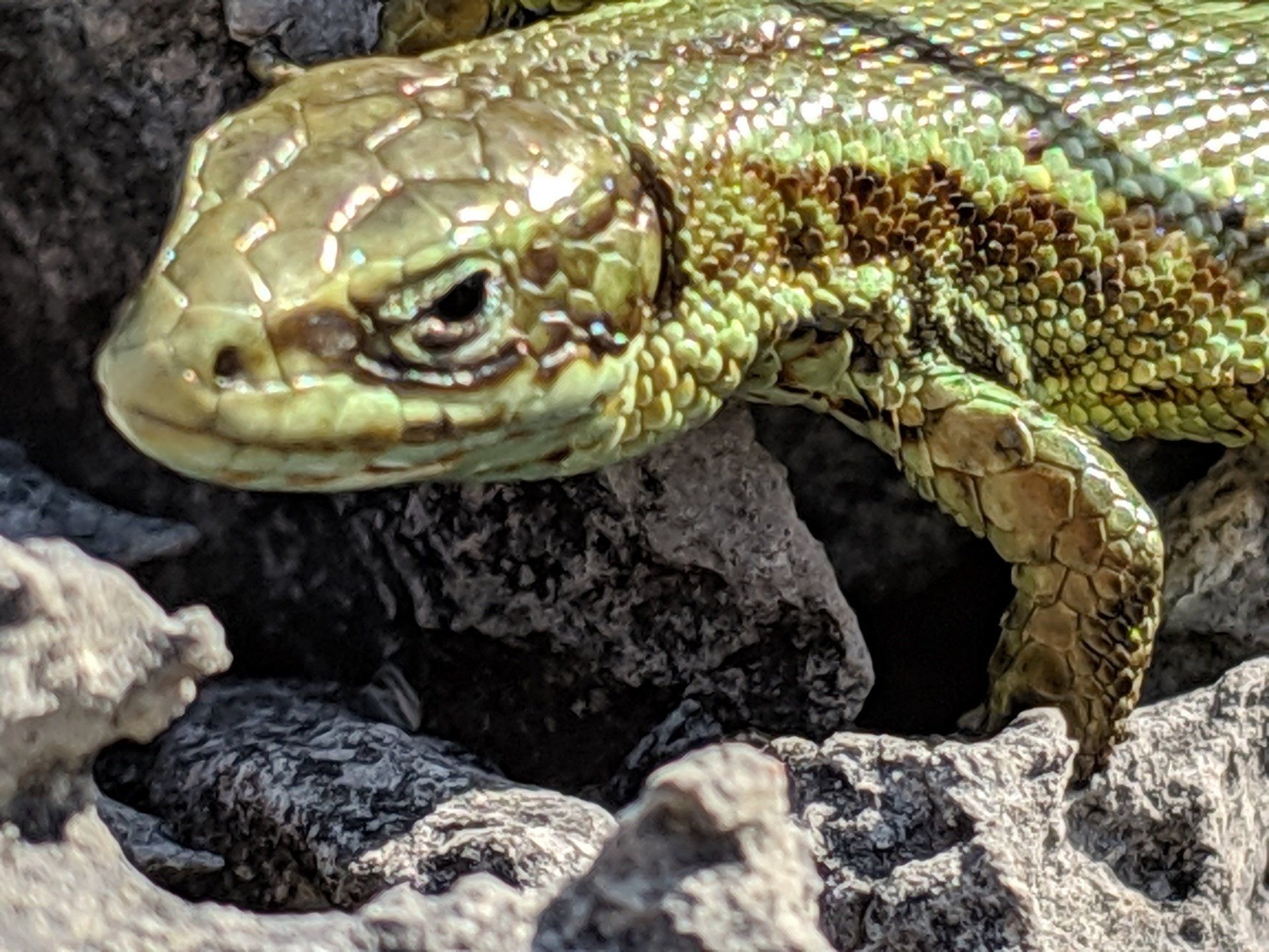
A reptile is a cold-blooded vertebrate animal that includes snakes, lizards, crocodiles, turtles and tortoises. We have one native reptile in Ireland and it is the viviparous lizard (Lacerta vivipara). Earc luachra is the Irish for the creature. A viviparous animal is one which brings forth its young live (as opposed to in egg form).

The viviparous lizard is the most northerly reptile in the world and can even be found within the Arctic Circle. It averages 10 to 16 cm in length. It suns itself in order to reach a body temperature of 30 degrees C. It is then able to hunt effectively. Diet is small insects.

The lizard's predators include kestrels, stoats and minks. If the predator grasps the lizard by the tail, the lizard divests itself of the tail piece leaving the aggressor with a stump. The lizard then grows back its tail.

In the pre-antibiotic era in Ireland, folk medicine was widely practised across the country. The medicine was a mix of the natural (cures from herbs, plants, minerals and animal substances of nature) and the magico-religious. The latter consisted of magic, religious/holy wells and healers (Barron Soverino 2018, 1)

One of the folk beliefs was that if a person licked a lizard, he/she could cure a person of a burn by licking it. There are a number of references to this cure in the Schools Collection for schools in North Clare (SC  Vol 0614, 321, Killinaboy ; Vol 0615, 307, Rathbaun ; Vol 0616, 049, Aill Bhéil an Tulaigh/ Ballyvaughan (Drumcreehy)). The Schools Collection is  a collection of folklore compiled by schoolchildren in Ireland in the 1930s.

The accompanying photo was taken in Ballyryan in the south-west of the Burren.

According to propaganda, Saint Patrick is credited with banishing snakes from Ireland. Tellingly, Patrick himself never made such a claim in his epistles. Snakes never reached Ireland. The snakes in the Patrick legend are a symbol of paganism.

Finally, there is actually one other reptile in Ireland. However, it is not native. It is the slow worm (Anguis fragilis). It is a legless lizard. Its range is confined to County Clare. The worm was introduced from another jurisdiction by misguided folk a couple of decades ago. As they say in Yorkshire - there's nowt as queer as folk.

Bí slán, sabháilte - Be safe and sound.

REFERENCES 
Barron, C. and T. Soverino 2018.  Put a frog in your mouth ; toothache 'cures' from Nineteenth- and Twentieth -century Ireland.  Journal of the History of Dentistry Vol  66, No.1.
National Folklore Collection  1937/38.  The Schools Collection.

By info@heartofburrenwalks.com 16 Apr, 2020

LOCATION
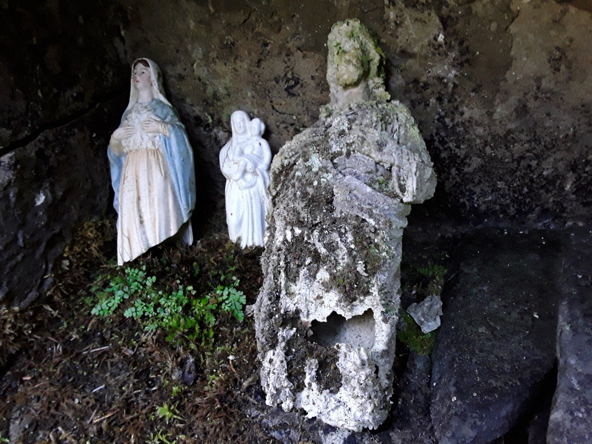
The well is located in a small cliff face in the townland of Rossalia on the north eastern slope of Abbey hill. It is 4 kilometres south east of New Quay and 11 kilometres west of Kinvara, Co Galway. An impermeable chert-rich zone on the limestone slope has caused a small outflow of water. The initial part of the outflow was walled in with a well house and is known as Tobar Phádraig (St Patrick’s Well).

An old, unsurfaced road (known as a “green road”) lies just below the well. Less than one kilometre to the east of the well, the green road links up with an ancient North Clare route way i.e. Carcair na gCléireach (literally the Clerics’ Slope), commonly known as the Corker Pass. This route from north Clare into south Galway dates back to the 16th century at least (Gosling 1991, 126). Thus, St Patrick’s has enjoyed a strategic location for centuries at least.

Furthermore, holy wells are often site-specific for symbolic reasons. Some are located on the sea shore (O’Sullivan/Dowling 2006, 37). Though St Patrick’s is not on the seashore, its expansive sea views means that the well enjoys a liminal land/water, world/otherworld location.  
BIBLIOGRAPHY
Gosling, P. (2001). The Burren in Medieval Times. The Book of the Burren . 2nd edition. Kinvara ; Tír Eolas.
O’Sullivan M. Downey L. (2006). Know Your Monuments Holy Wells. Archaeology Ireland. Spring Edition. Dublin Wordwell Books.

By info@heartofburrenwalks.com 26 Mar, 2020
INTRODUCTION
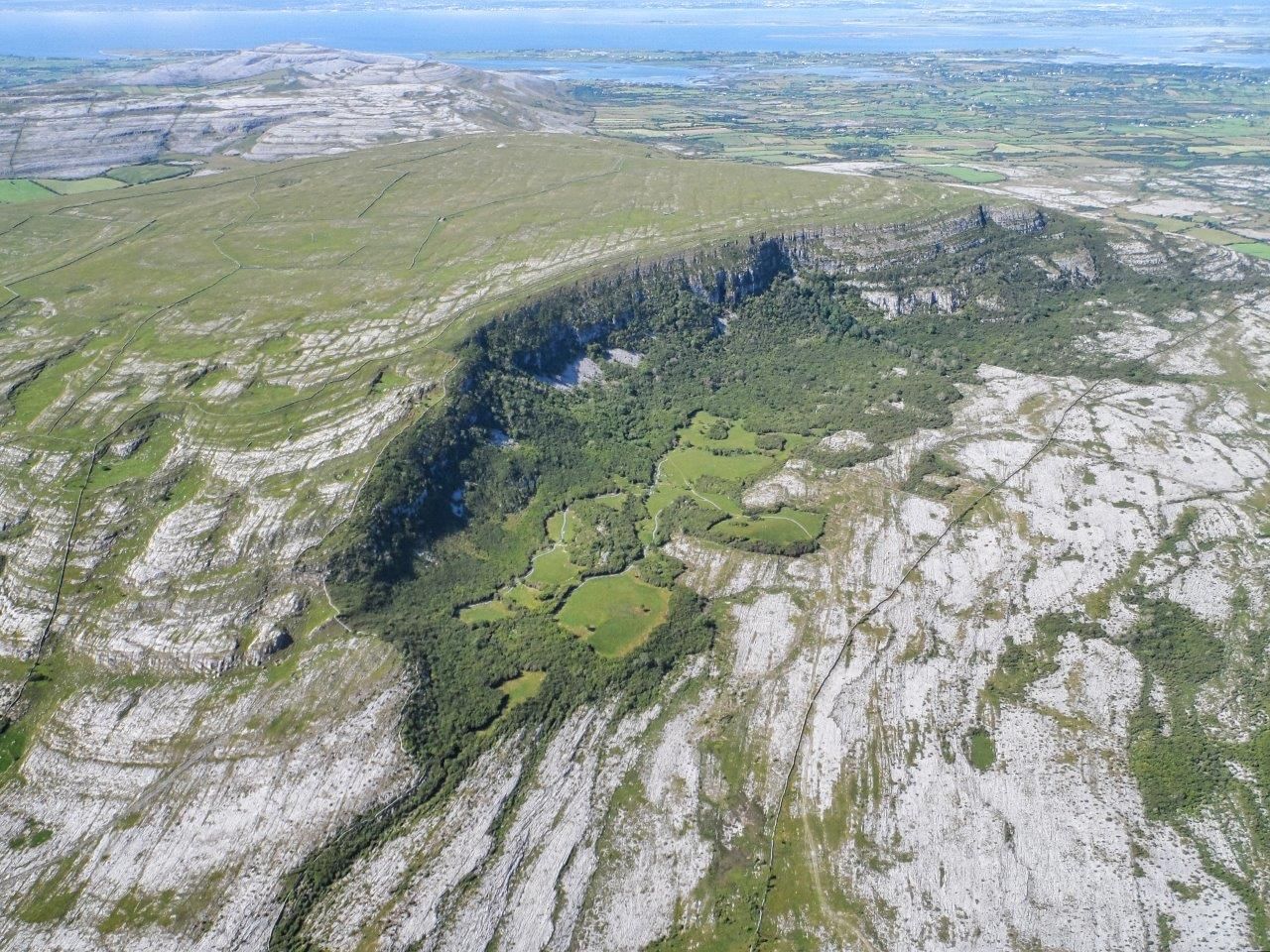
I had thought that the nearest County Clare had to an inhabited Atlantic island was Inis Oírr. It is known affectionately on occasion as "the Clare Aran" on account of it strong historical links with Clare. However, Inis Oírr enjoys stronger links with the Galway mainland today and is administratively part of County Galway. Inis Oírr is like its sister islands, Inis Meáin and Inis Mór, a Galway island.

Nonetheless, it did dawn on me quite recently that Clare does in fact have its own inhabited Atlantic island. It is Aughinish in the extreme north-west of the county. Some argue that Aughinish was only an island for a brief period from its detachment from the mainland in the 1750s to its re-attachment via a causeway in the early 1800s.

However, since Aughinish was "islanded" by a natural event (a tsunami) and "de-islanded" by a man-made structure (a causeway),  it is still technically and resolutely an island .  Aughinish enjoys its deserved place amongst the 570 islands documented in the encylopedic Irish islands guide Oileáin by David Walsh (2004, Pesda Press).

THE STORY OF AUGHINISH

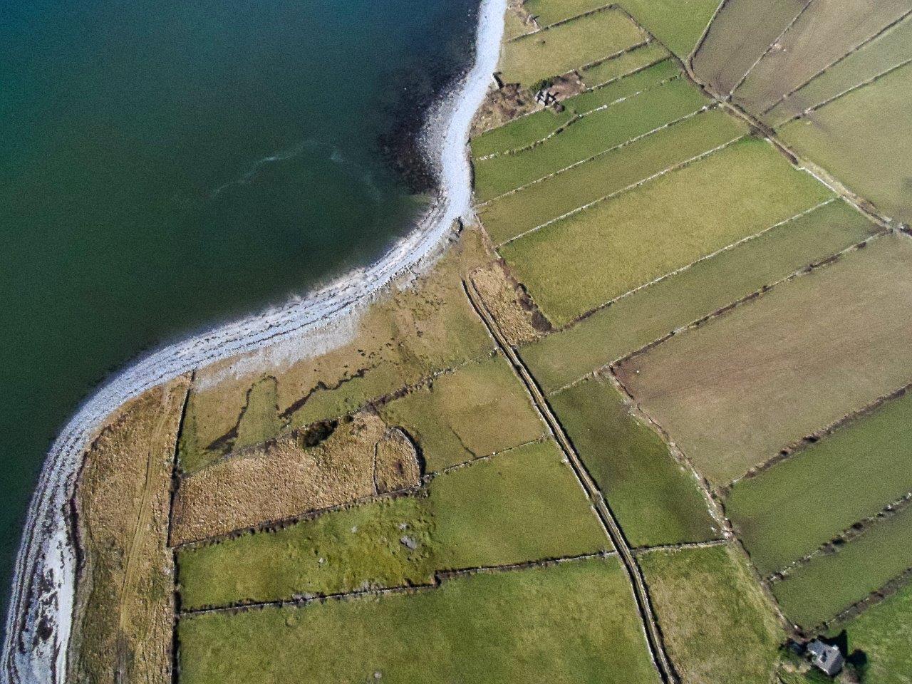
Aughinish is a townland located in the very north of County Clare on the southern shores of Galway Bay. It is separated from the rest of Clare by water. Aughinish is peculiar in that it is only accessible by land via the neighbouring county of Galway. It is a small reality - only about 3 kilometres long and 1.6 kms wide.  

The place name is an English language mangling of the Gaelic Eachinis . Eachinis translates as Horse Island. "Ock-in-ish" is how the locals pronounce the name.


Aughinish was originally connected to County Clare. However, that connection was lost in 1755 due to the tsunami effect of the enormous Lisbon earthquake. The Great Lisbon Earthquake may have caused the deaths of up to 50,000 people. Its shocks were felt as far south as North Africa and as far north-west as the west coast of Ireland.
Subsequently, the British built the 0.80 km causeway from Aughinish to the County Galway mainland in order to service their troops in the martello tower constructed on the island after 1811.

Martello towers are circular coastal fortifications which the British built along the Irish coastline (and the coastline of the south east of England) in the early years of the 19th century as they feared a Napoeonic invasion of the then United Kingdom of Great Britain and Ireland. Aughinish's modern history has thus been literally shaped by two great European events - the 18th century Lisbon earthquake and poor Anglo-French relations at the turn of the 18th and 19th centuries.

Despite the causeway, Aughinish has an island-like feel to it.......a place apart with only about 50 inhabitants. The  population was more than 300 people prior to the Great Hunger of 1845-49 (Swinfen 1992, 7).

Aughinish's remoteness means that only the most intrepid visitor will seek it out. A visit is more than worth it as the island is not only rich in history and heritage but it also enjoys a beautiful coastal location. 

BIBLIOGRAPHY
Swinfen, A. (1992). Forgotten Stones Ancient Church Sites of the Burren and Environs.  The Lilliput Press.

By info@heartofburrenwalks.com 16 Dec, 2019

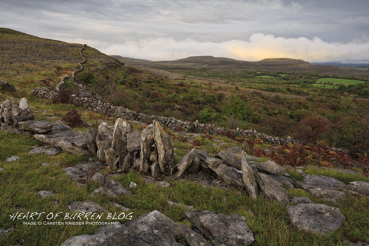
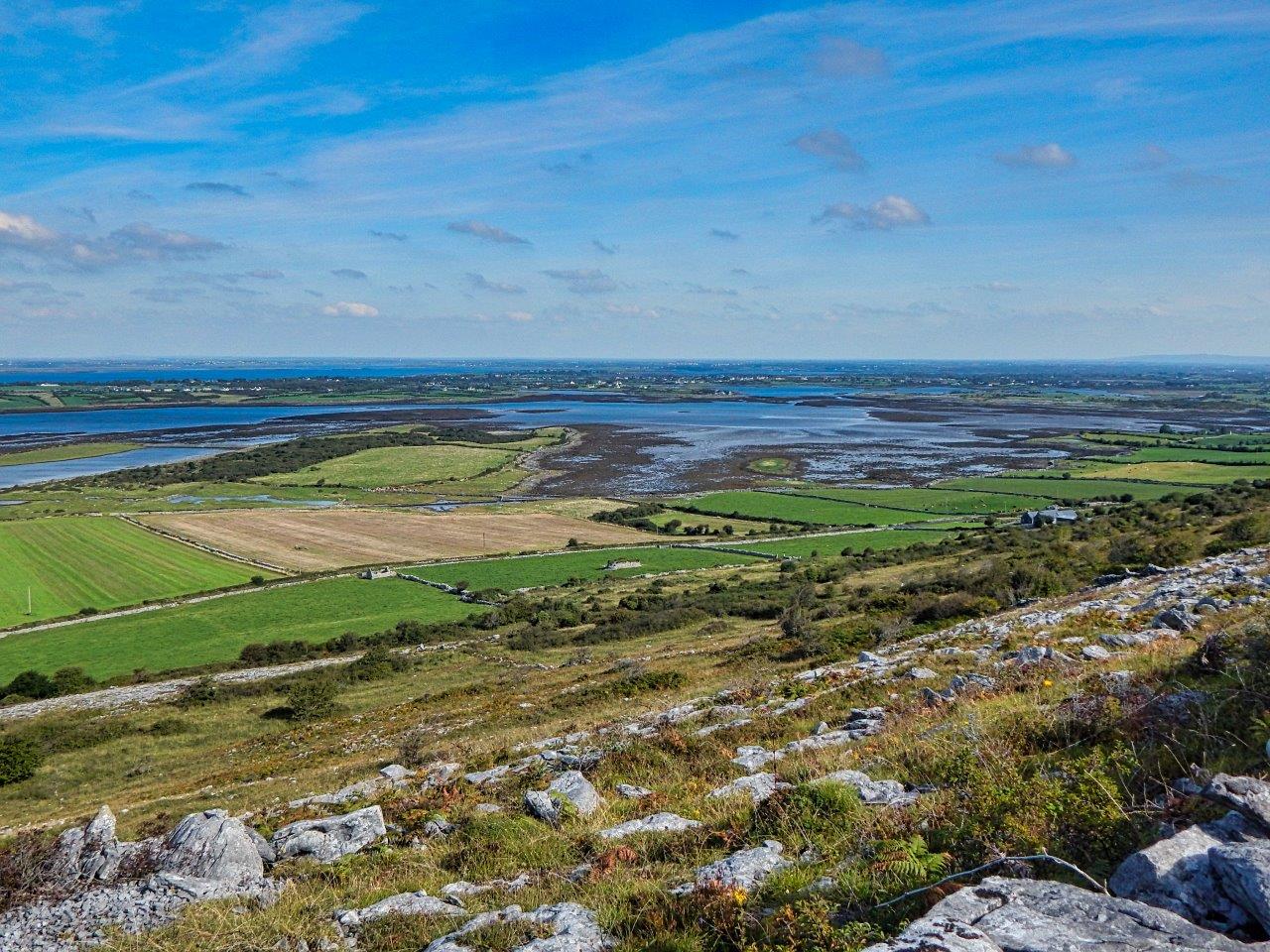
22nd of November in the year '19. In the bleak winter. A rare day for life in Ireland.

The late afternoon view south from Termon in Carran as "the wind and light are working off each other".

The latter is a line from the poem "Postscript" by Séamus Heaney. The poem was first published in The Irish Times. Heaney described it as "a sidelong glimpse of something flying past". He won the Nobel Prize in Literature in 1995. Heaney passed away on August 30th 2013. He was 74 years of age.

"I Need You at the Dimming of the Day" is a powerful love song written by the great English folk artist Richard Thompson. The song is from the album "I Want to See the Bright Lights Tonight" released by Richard and Linda Thompson in 1974. The album was critically ignored and commercially unsuccessful. It is now considered to be a masterpiece. Thompson played the Royal Albert Hall in London on the 30th of September this year to celebrate his 70th birthday.

More Posts
Share by: