


Knockaunroe Turlough Walk. Orange Route. Burren National Park.
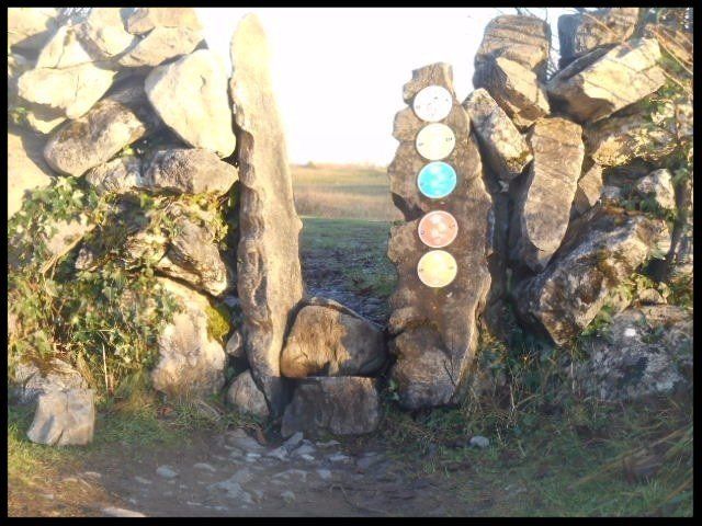
Start/finish: Gortlecka Cross Roads, Burren National Park, Kilnaboy.
Description: Way marked trail with orange arrows suitable for most levels of fitness. Highlights include a turlough, mature ash/hazel woodland, flower-rich grasslands and some fine views of the National Park's iconic hill, Mullaghmore.
Distance 1.3 km (0.8 mile) .
Map: The Burren - a two inch map of the uplands of north-west Clare. Folding Landscapes. Scale 1:31680 or Discovery Series Map No 51. Ordnance Survey of Ireland. 1:50 000
The first two fields you walk through are very rich and diverse in wildflower species and are defined as flower-rich grasslands. Horses and ponies graze in the fields in winter thus preventing the encroachment of the surrounding hazel woodland. The horses and ponies are an uncommon sight in the hills in winter as it is primarily cattle which are transferred to altitude from November to April each year. Hay may be saved on occasion in these meadows but only after the flowers have gone to seed. The fly orchid ( Ophrys insectifera ) and the bee orchid ( Ophrys apifera ) are two of the most spectacular flowers here in summer with their remarkable exercises in insect mimicry.
On
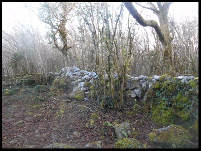
leaving the second field you may notice a quarry – a reminder of the abandoned
National Park Visitor Centre and car park project of the 1990s. Proceed along a
path through woodland and pass through a metal gate into grasslands.
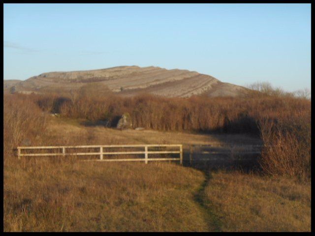
If you look north-west here you will get a striking view of the iconic
Mullaghmore hill. The great expanses of limestone pavement on the hill have
been exposed by glaciation and over-exuberant farming in pre-history. It is ironic
that the wealth of geology, flora and archaeology in the region are in part due
to ancient “agri-vandalism”. The Burren is a highly paradoxical landscape
brilliantly summarized in the cartographer/essayist Tim Robinson's words
"it’s (the Burren's) austere beauty is the result of millenia of abuse
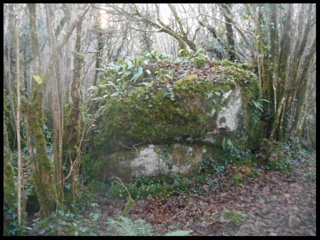
You enter mature hazel/ash woodland which
is home to such mammals as badgers, red squirrels and pine martens. There are
an estimated 70,000 badgers in Ireland. The animal's feeding behaviour is very
similar to that of the badger in Spain and Italy. Mammalians believe the badger
was introduced to Ireland by prehistoric farming communities migrating
northwards via the Bay of Biscay.
The pine marten is Ireland's most elusive land mammal. It is largely nocturnal.
The marten population plummeted during the notorious 17th century deforestation
program. However, its numbers are on the rise again in the west of Ireland.
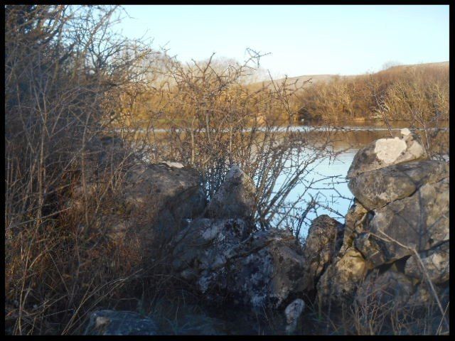
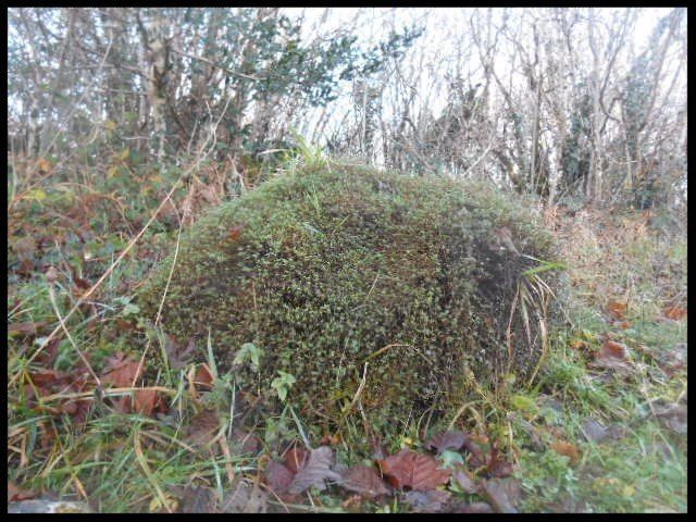
You will reach a clearing in the woodland on your left hand side. In summer it may be recognizable as a dry depression with a very interesting mix of aquatic plants including purple loosestrife ( Lythrum salicaria ), water mint ( Mentha aquatica ) and mudwort ( Limosella aquatica ). The depression fills with water in periods of high rainfall, (mainly winter). Groundwater wells up from below and a temporary lake (Knockaunroe turlough) is formed. Scarce plants nationally such as shrubby cinquefoil ( Potentilla fruticosa ) and purgative buckthorn ( Rhamnus catharticus ) prosper at the turlough margins. Dragonflies and damselflies are quite common around turloughs. Ireland is home to 13 dragonfly and 11 damselfly species. Dragonflies are much faster in flight than damselflies.
You soon re-enter the woodland. Almost all
the woodland along the trail was coppiced in the past. The long straight shoots
of hazel are evidence of the ancient tradition.
Coppicing is a sustainable method of woodland
management which in Ireland’s case dates back
to the Neolithic farmers (4000-2400 B.C.). The method exploits the ability of many
species of trees to grow new shoots from their stump if cut down. Nearly all
broadleaf trees will grow back when coppiced. Ash and hazel grow back very
vigorously.
Coppicing was a thriving industry in the Burren in the past - producing slim poles for fencing, charcoal, thatching rods, walking sticks, stakes for hedge laying, firewood and much, much more. It fell out of fashion here in the 20th century because of labour costs and cheaper imports.
The Burren mosaic of limestone pavement and thin soil is evolving in to woodland because of lack of human pressure i.e. the decline of two traditional economic activities - upland farming in winter and coppicing.
The trail opens out onto species rich-grasslands. Devil's bit scabious ( Succisa pratensis ) blooms in great profusion in late summer/early autumn. Its tall, purple flower heads make for a wonderful spectacle. Mullaghmore comes in to view again as you land back at the trailhead.
CONCLUSION
The orange trail is short and does not feature the region’s iconic limestone pavement. However, it is very rewarding as high points include a rare eco-system in Knockaunroe turlough and an outstanding example of mature, native woodland. Another bonus is that the trail is one of the least trafficked in the region. Happy feet!
