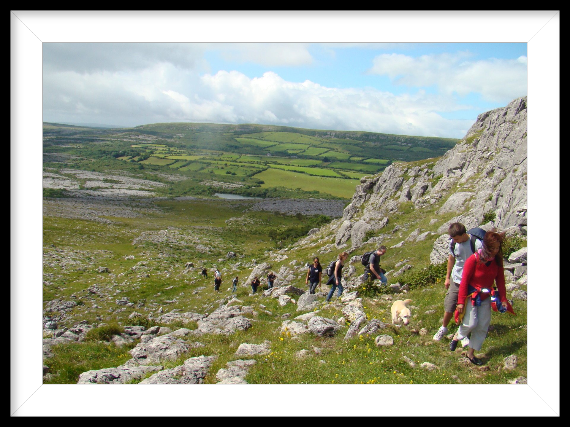
Burren National Park Hike
Start and finish: Gortlecka Cross Roads, Burren National Park, Killinaboy.
Description: A strenuous climb of three of the Burren’s most eccentrically-shaped hills. Much of the walk crosses limestone pavement, which is uneven terrain. Mullaghmore, the first of the three hills, is way marked. Sliabh Rua and Knockanes have no way markers.
Highlights :
Great
views of parts of Clare and Galway countryside. Two substantial prehistoric
cairns crown the summits of Mullaghmore and Knockanes. Uncommon turlough flora
and many different orchid species can be seen during the flowering season
Distance:
13.5 kilometres. Time:
5.5
hours. Grade
: Strenuous.
Map: The Burren - a two inch map of the uplands of north-west Clare. Folding Landscapes. 1:31680 or Discovery Series Map No 51. Ordnance Survey of Ireland. 1:50 000.
Turn right at Gortlecka Cross Roads on to Crag Road. Walk a kilometer along this road till you come to a stile on the left had side of the road with an information display board. Proceed through the stile towards the dramatically folded Mullaghmore hill.
You will soon see flood debris, (a trail of dead plant material), which signals the winter high-watermark of the Lough Gealáin turlough (seasonal lake). Northern bedstraw ( Galium boreale ), marsh dandelion ( Taraxacum palustre ) and fen violet ( Viola persicifolia ) are uncommon wildflowers in Ireland and Britain. However, with careful searching you may be lucky to see them here in spring between the summer low-watermark and the winter high-watermark of the turlough.
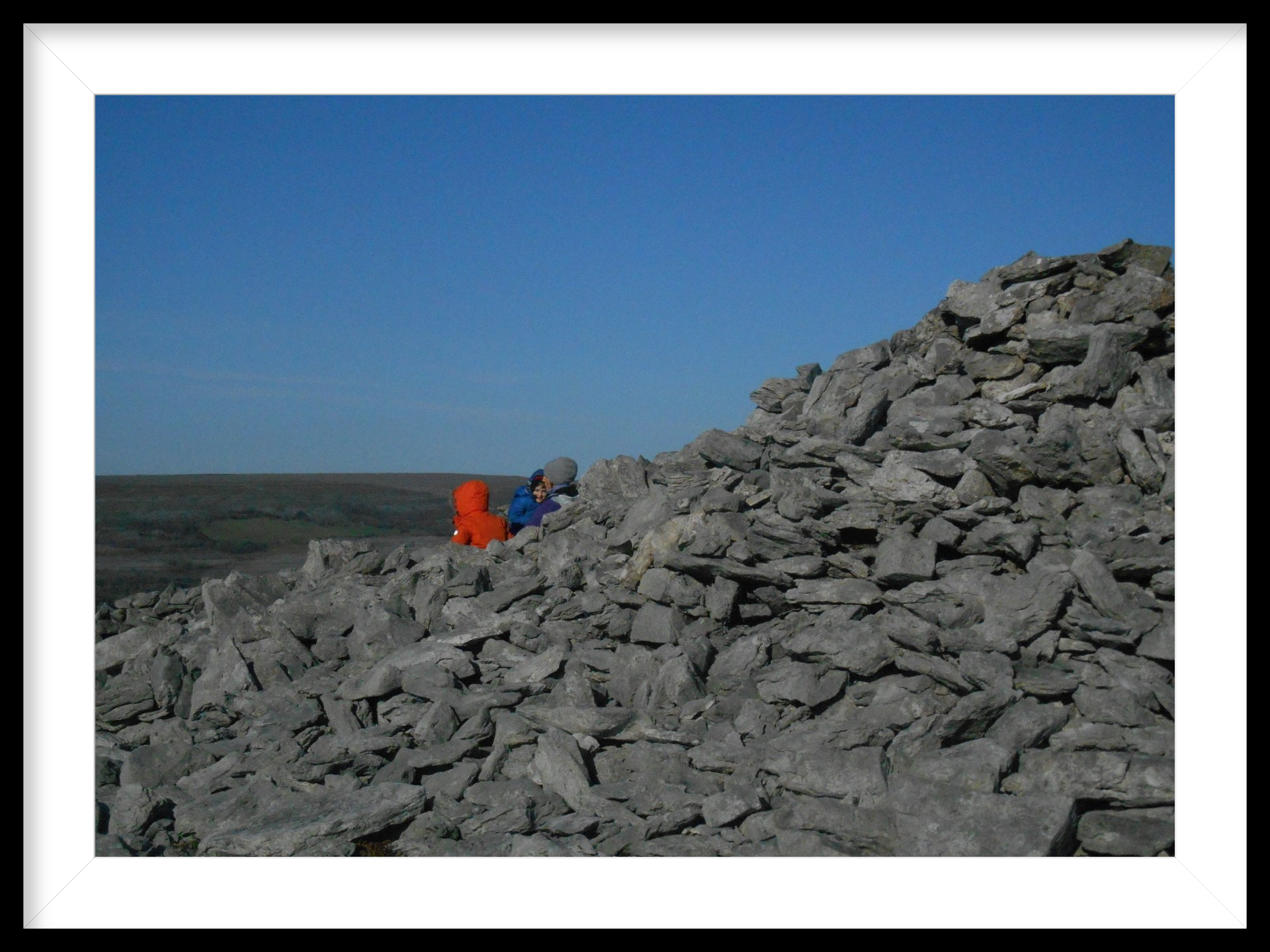
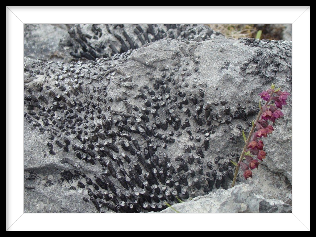
The ascent is along a stone-bordered path. Keep an eye out for the fossils of colonial corals along the way - they look like black nodules.
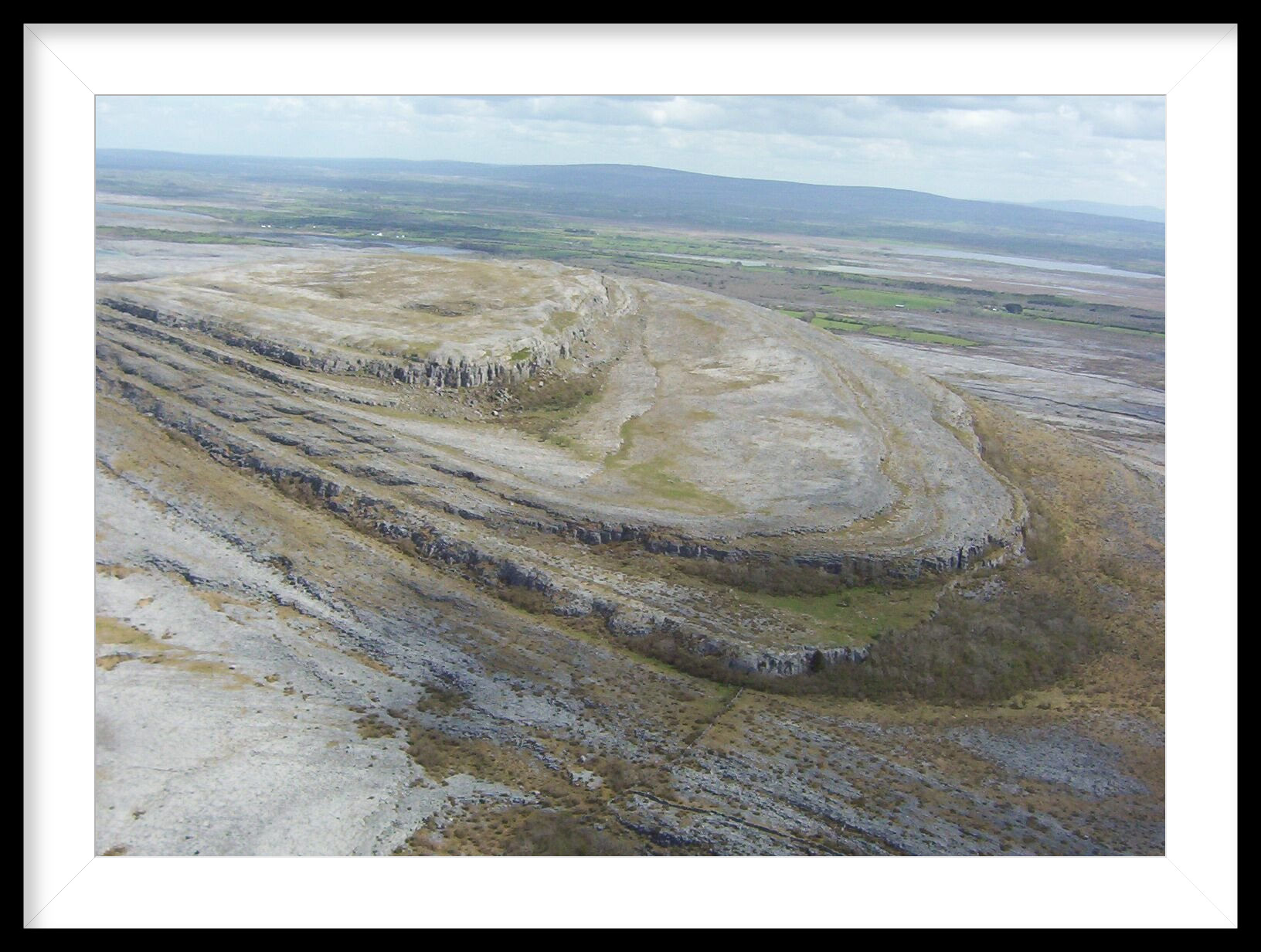
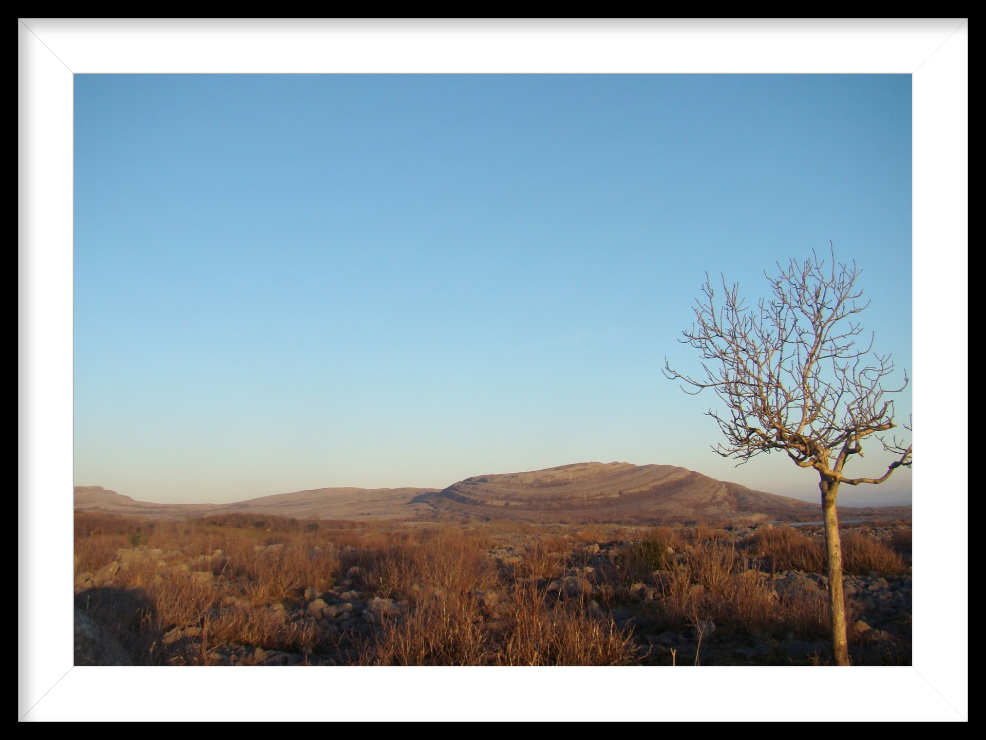
The Burren hills are characterized by terrace-and –cliff topography. You cross two terraces and ascend the trail alongside a couple of cliffs before you see the summit of Mullaghmore ahead of you to the north.
Mullaghmore is crowned by a cairn – a huge aggregate of loose stones within which the bones of Stone Age or Bronze Age special dead are interred in chambers or stone boxes. Cairns also functioned as temples where the living practiced religion and ritual.
The late, great Burren writer and philosopher, John O Donoghue, considered Mullaghmore to be a sacred mountain and memorably wrote “Mullaghmore is the tabernacle of the Burren. Once glimpsed it can never be forgotten”.
The grasslands at the summit of Mullaghmore provide sweet, nutritious feed for the cattle in winter. The limestone absorbs heat in spring/summer and releases it in autumn/winter. The resultant benign winter is one of the incentives the farmer has for out-wintering the cattle on the Burren hills. The Burren is one of the few regions in the world livestock are transfeered to altitude in winter. The summit of Mullaghmore abounds in spring with the lemon-yellow delicate flowers of the hoary rock-rose (Helianthemum oelandicum ) – a rare plant in the north of Europe.
The summit offers excellent views of the hinterland. The dwelling used as the parochial house in the ecclesiastical TV comedy series Father Ted is due west of the peak. The 400 million year old sandstones of Slieve Aughty in East Galway are to the north-east.
Slieve Aughty is home to a huge wind farm whilst Maghera is the name of the hill in Clare to the east. The antenna on the hill serves as a regional radio and television transmitter. Lough Bunny, (the largest lake in the east Burren wetlands), is to the east in the foreground. The lake is 195 hectares in area and much of it is surrounded by limestone pavement.
Proceed along the peak of Mullaghmore in a north-easterly direction towards Slieve Rua. As you descend Mullaghmore, you see ahead the stunning folds on the southern slopes of Slieve Rua.
Mullaghmore, Slieve Rua and Knockanes serve as a fine study in glacial erosion, tectonic processes and dissolution by rainwater. The limestone was laid bare by the erosive action of great ice sheets. The terrace and cliff formation was formed by the stripping effect of both water and ice on the weaker points of the rock mass. The huge swirls were created by tectonic movement in the earth's crust. The earth movements had the effect of distorting the hills in this south-eastern corner of the Burren into a series of folds. The cumulative impact of nature’s forces is the formation of one of the most distinctive hill ranges in Ireland.

Having climbed to the top of Slieve Rua, Knockanes is to the north-west. The Knockanes peak can soon be reached by crossing the saddle between it and Slieve Rua. Knockanes also has a cairn on its summit. Galway Bay and South Connemara are visible on a fine day from here.
You do not have to cross the summit of Mullaghmore again on your journey back. When you reach the saddle between Slieve Rua and Mullaghmore, just follow the arrows in a westerly direction in order to return to the trailhead along the western slopes of Mullaghmore – homeward bound after an exhilarating National Park hike!
Finally – what’s in a name. Most family and place names in Ireland were anglicized during the colonization and have been rendered meaningless. One must revert to the original Gaelic names to get any sense of meaning. Thus, Mullaghmore is from Mullach Mór (the big top). Slieve Rua is from Sliabh Rua (the red hill) and Knockanes comes from Cnocán (little hill)…and slán tamall means bye for a while!